California Collaborative for Natural Climate Change Solutions
Isoemissions
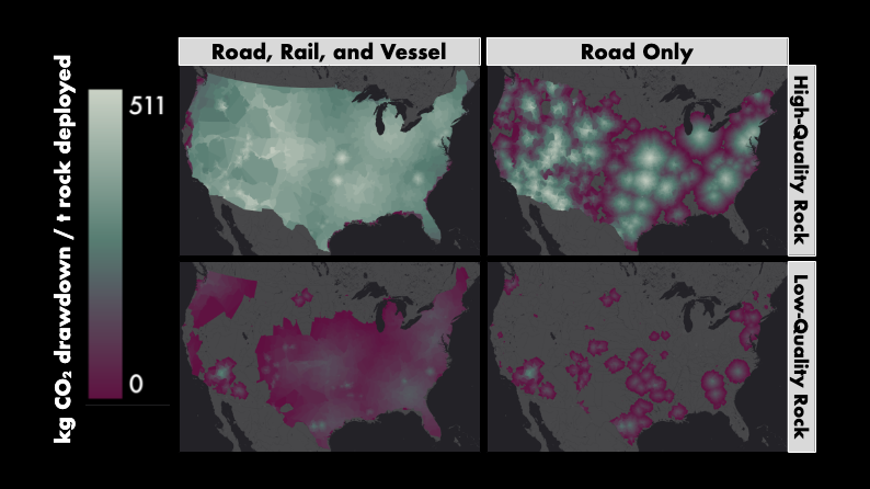 Carbon dioxide removal (CDR) at scale will depend on the use of existing infrastructure for production, transportation, and deployment of materials. Transportation is a potentially serious carbon bottleneck for many CDR solutions, since sources of material like mines and biochar facilities are often far from suitable deployment sites. While life-cycle analyses can estimate some of the impacts of transportation emissions on net CDR, they tend to be project-specific and thus have limited applicability at the regional or national scale. To address this gap, I've introduced the concept of the transportation isoemission, defined as the area around a material source that can be reached within a given amount of emissions, and developed an analysis pipeline that can be applied to a range of both land- and ocean-based CDR solutions. To carry out the analysis for enhanced rock weathering (ERW), I've estimated the minimum and maximum CDR potential of crushed rock for more than 3,000 currently operating mines across the conterminous United States, Hawai'i, and Puerto Rico, and then used real road, freight rail, and waterborne bulk carrier networks to create isoemissions for each mine and for the country as a whole. These national maps are then used to calculate potential CDR for different land uses, including specific crop types, irrigation strategies, and grazing systems. We will also analyze the maps against a range of environmental justice metrics to assess which communities may benefit most from incentives for implementing ERW. Especially when combined with deployment site-specific data, as we plan to do in a future decision support tool, isoemission maps have the potential to identify highly suitable deployment sites and address critical concerns about environmental, social, and economic implications for a wide range of CDR solutions.
Field trials at UC Research and Extension Centers
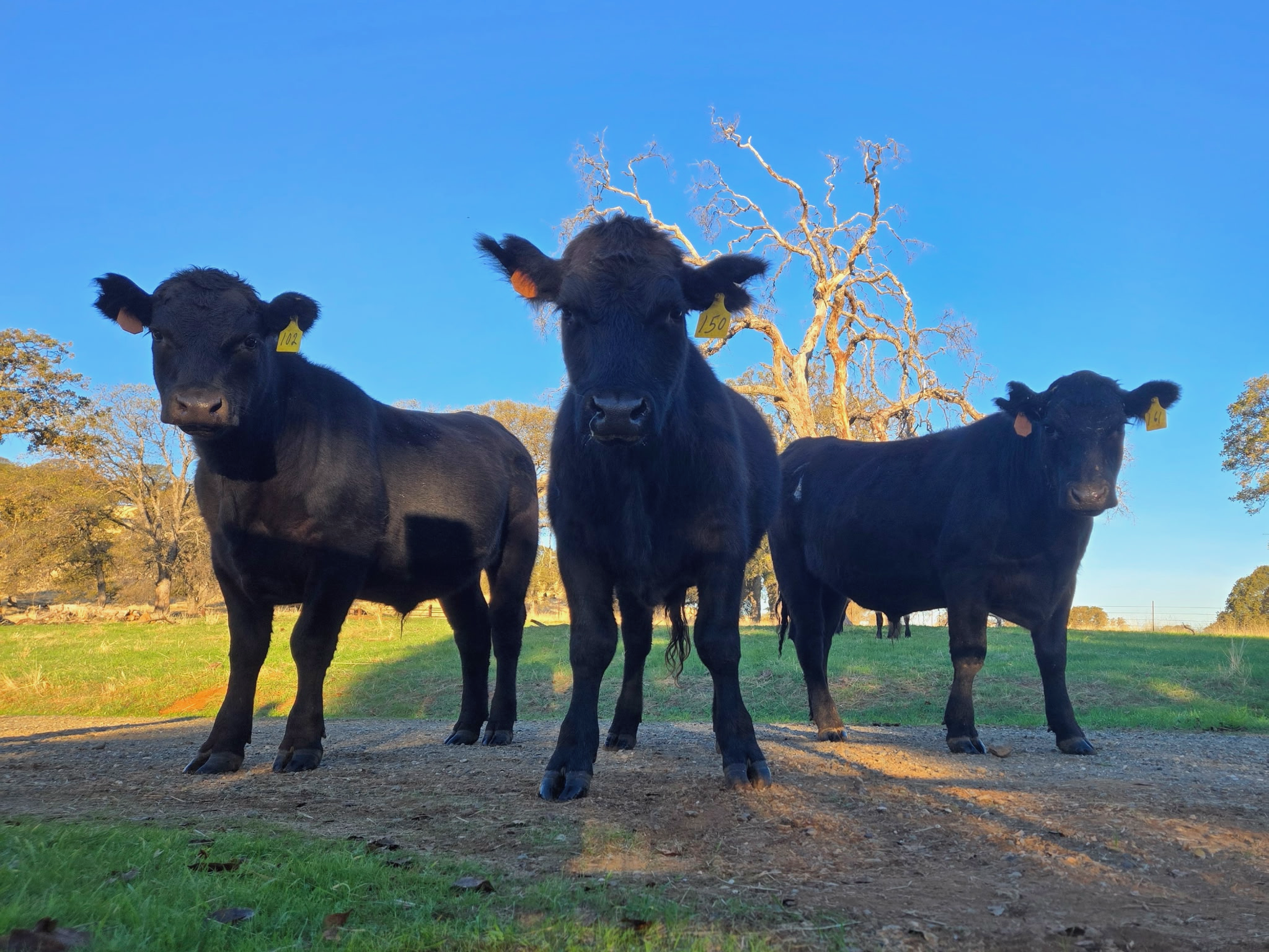 Our group has three ongoing enhanced rock weathering field trials at two University of California Research and Extension Centers (RECs). One trial at each REC features basalt and compost applied in a fully-factorial replicated block design, which we are using to identify potential synergies and tradeoffs of stacking mineral and organic soil amendments. Our third trial at Sierra Foothill REC is made up of two half-acre plots on a steep hillslope with shallow bedrock that forces any rain or irrigation to move through the soil as lateral subsurface flow; we've installed a comprehensive hydrologic sampling and monitoring infrastructure at this site that allows us to track fluxes of weathering products from source to sink. In addition to developing our forage sampling protocol, I'm primarily responsible for organizing and analyzing our soil, plant, and water samples.
U.S. EPA Office of Superfund Remediation and Technology Innovation
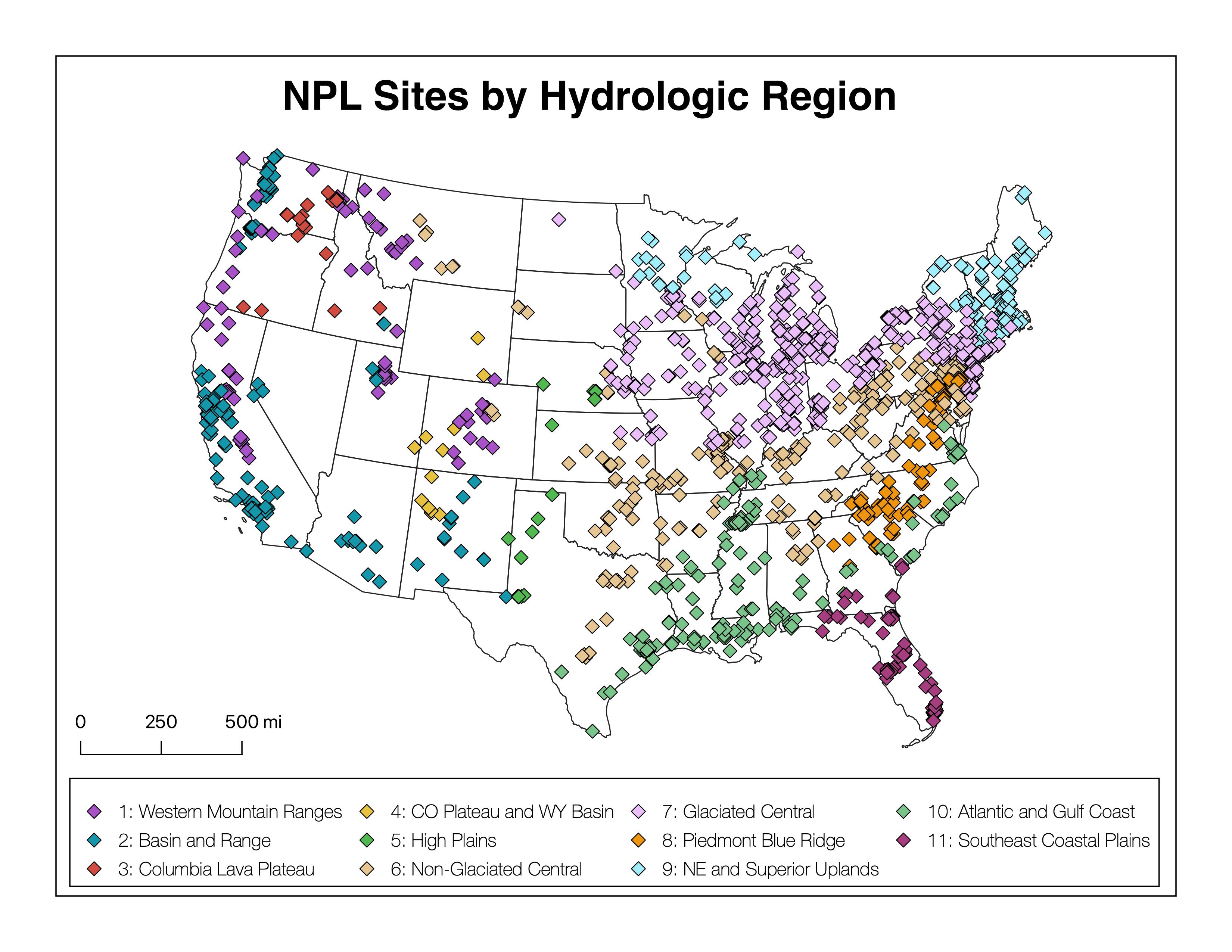 As an intern with the Office of Superfund Remediation and Technology Innovation I critically evaluated updates to U.S. EPA's Soil Screening Guidance, which informs the early stages of risk assessment at National Priority List (Superfund) sites. To address discrepancies in how different chemicals move through the vadose zone and into groundwater, I developed a decision support tool that can assess the degree of attenuation of over 30 organic contaminants (including emerging contaminants like PFAS) in groundwater. I also worked on hydrogeologic-region-specific dilution-attenuation factors, which represent a major improvement over the current recommendation of a single, nationwide average value.